Magnetic Mappers: Using Magnetic Field Variations to Identify Blockages and Alternative Routes During Natural Disasters
Alia Nasir Muhammad & Hodasadat Tabatabaei Yeganeh Dubai National School–Al Barsha
Increased Number of Natural Disasters
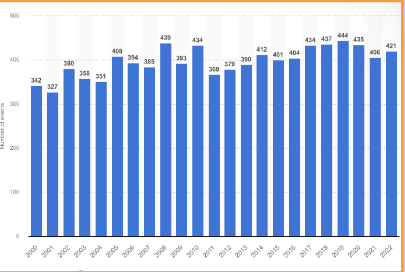
According to the United Nations, the number of natural disasters have increased five-fold in the last fifty decades. Additionally, there were 421 natural catastrophe incidents reported globally in 2022, an increase from the 406 events reported in the previous year. Furthermore, it has been calculated that global disasters resulted in a $250 billion dollar loss.
Blocked Paths During Natural Disasters Hinders First Responders
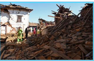
Emergency services like ambulances and temporary shelters are blocked due to road disruptions, which often occur due to falling debris from damaged buildings. As a result, a community’s recovery is impeded, leading to increased damages and casualties.
Time is Critical During Times of Crisis
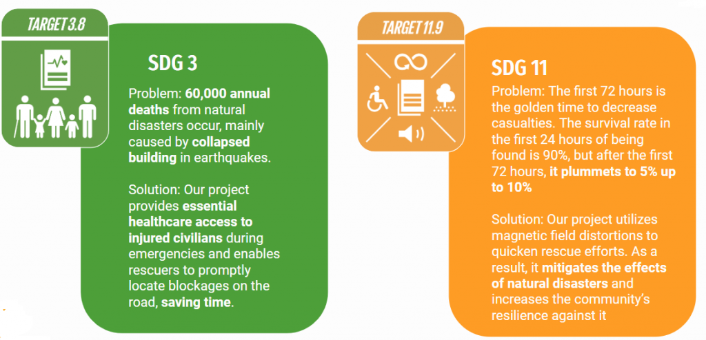
The first 72 hours post-disaster are crucial for saving people’s lives, and proper action during this period can reduce casualties or damages. In addition, preparedness, which can be through understanding the area properly, saves lives, accelerates recovery, and reduces costs. Every dollar invested in disaster risk reduction saves $3 to $15 when a disaster strikes.

Current Technologies Used by Responders Are Not Efficient
GPS
First responders use GPS to know the location of disasters or to identify victims that have devices with GPS receivers. However, it can be inaccurate, and it is often outdated. Also, GPS tracking may not be available in remote or rural areas that have limited cellular coverage.
Remote-Sensing Data
Remote-sensing data collection is the process of gathering information from a location from a distance using passive satellites–satellites that gather data from the signals from the Earth’s surface. This method is not effective in all weather conditions (for example, clouds can obstruct ground features), and updates infrequently/p>
Therefore, we must find innovative solutions to assist rescuers during natural disasters!
Background Research: Gizmos “Magnetism” Simulation
Through this simulation, we learned valuable information.
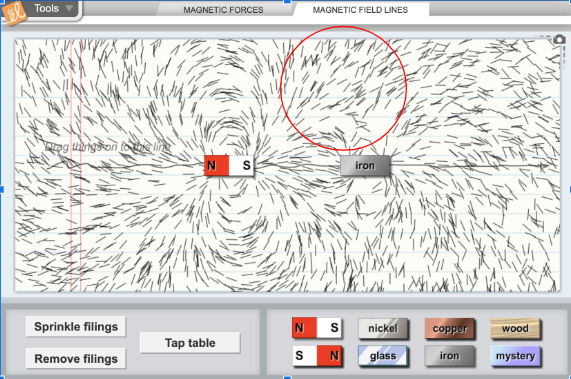
- Definition: Ferromagnetic materials are materials that are highly attracted to magnetic fields, such as iron (which makes up 97% of steel)
Effect: Ferromagnetic materials distort Earth’s magnetic field lines
Background Research: Gizmos “Magnetic Induction” Simulation
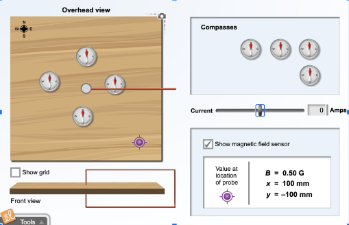
Earth’s Normal Magnetic Field Before Inducing a Magnetic Field
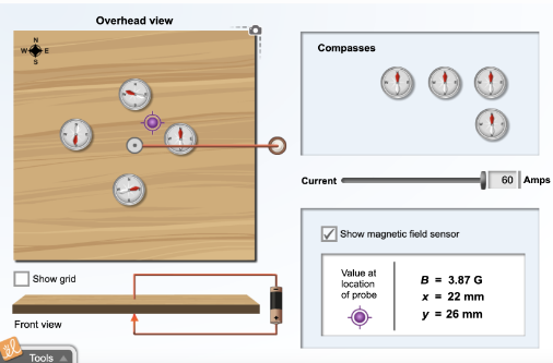
Earth’s Altered Magnetic Fields After Inducing an External Magnetic Field
We learned that magnetic field sensors detect the direction and magnitude of magnetic field distortions by first calibrating to set a reference point for the local magnetic field, then measuring any variations from this reference.
Background Research: External Research
These Gizmos simulations inspired us to research further on magnetic field distortions, finding the following:
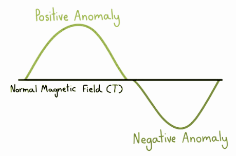
Definition: A magnetic distortion, also known as a magnetic anomaly, occurs when the local magnetic field varies due to the presence of ferromagnetic materials
Types: As seen in the image on the left, a positive magnetic anomaly exceeds the local magnetic field, while a negative magnetic anomaly is lower than the local magnetic field.
HYPOTHESIS
Hypothesis 1
Blockages on the road due to cars or broken buildings can be highlighted based on magnetic field distortions caused by construction parts, such as steel, which are known to cause magnetic anomalies.
Hypothesis 2
By developing software capable of integrating magnetic field data with GPS data for an area affected by natural disasters, navigation during natural disasters becomes more efficient.
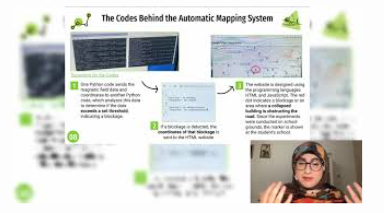
The Codes Behind the Automatic Mapping System
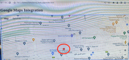
The website is designed using the programming languages HTML and JavaScript. The red dot indicates a blockage or an area where a collapsed building is obstructing the road. Since the experiments were conducted on school grounds, the marker is shown at the student’s school.
Document of the codes
One Python code sends the magnetic field data and coordinates to another Python code, which analyzes this data to determine if the data exceeds a set threshold, indicating a blockage.
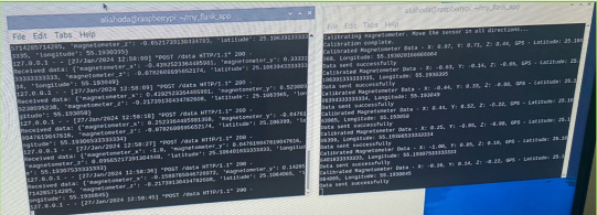
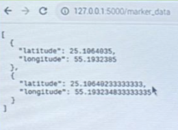
If a blockage is detected, the coordinates of that blockage is sent to the HTML website
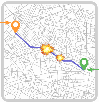
The Result of the Automatic Mapping System
The red dots represent blockages caused by cars or collapsed buildings on the road. The system automatically adds a red dot to the map when it detects a blockage or when a first responder clicks on the page to mark a blockage. Additionally, the map displays all possible routes from the origin to the destination based on the chosen mode of transportation (Transit, Car, Bike, Walk). This allows first responders to either use another route or to check that blockage for any injured civilians.
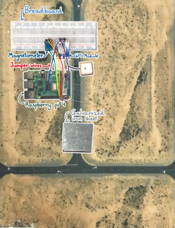
Materials
Display of the Mapping System
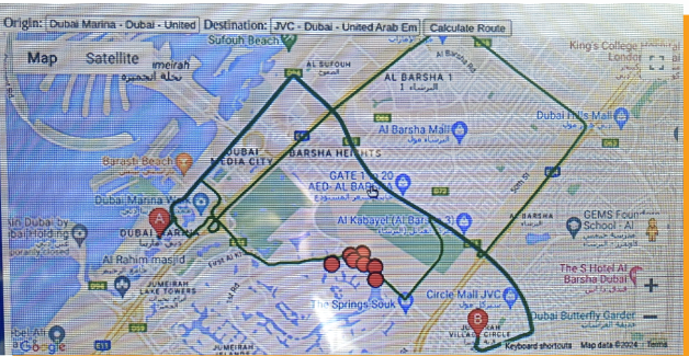
The red dots represent blockages caused by cars or collapsed buildings on the road. The system automatically adds a red dot to the map when it detects a blockage or when a first responder clicks on the page to mark a blockage. Additionally, the map displays all possible routes from the origin to the destination based on the chosen mode of transportation (Transit, Car, Bike, Walk). This allows first responders to either use another route or to check that blockage for any injured civilians.
CONCLUSION: Applying This Project on a Larger Scale to Assist Official Organizations
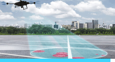
Applying our system on a drone allows first responders to detect blockages at all times and locations.
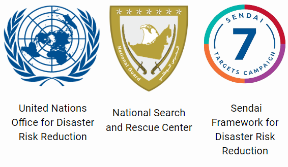
Through this, we assist the following official organizations:
CONCLUSION: Our Project Supports Two Sustainable Development Goals (SDGs)
Maps that identify blockages will be silent heroes during disasters, bridging the gap between survival and rescue!